Data management system for geo-related monitoring apps
Cautus Web is a market-leading data management system used in geo-related monitoring applications.

The Client
Cautus Geo is a global provider of secure geo-monitoring solutions and automatic measurement systems for land, water, and vulnerable structures. Their in-depth expertise covers complex geo-monitoring systems, mapping and surveying, GIS, data management, and the development of hardware and software solutions. Cautus Geo leads the way in developing innovative technology to ensure safety and security.
Cautus Web, one of the flag solutions by Cautus Geo, is a market-leading data management system used in geo-related monitoring applications. As a web app, it serves as a principal visualization and data management tool. Cautus Web can visualize almost any type of data in a scientific quality approach. The system also includes advanced in-house alerting tooling.
Cautus Geo
FromNorway
The Challenge
Cautus Web project’s main challenge was implementing and evolving complex web applications that could be used daily by scientists, researchers, and engineers. A rough list of functionality includes:
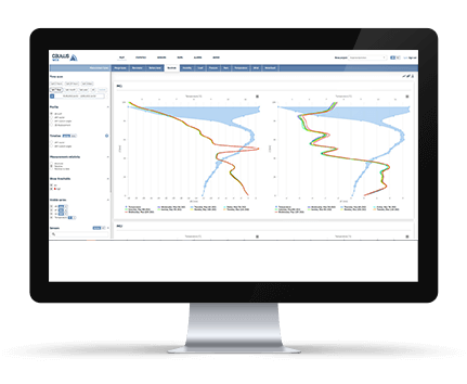
- measurements visualization in dozens of ways, including units conversion, data relativity, and charts export features
- measurements statistics calculation
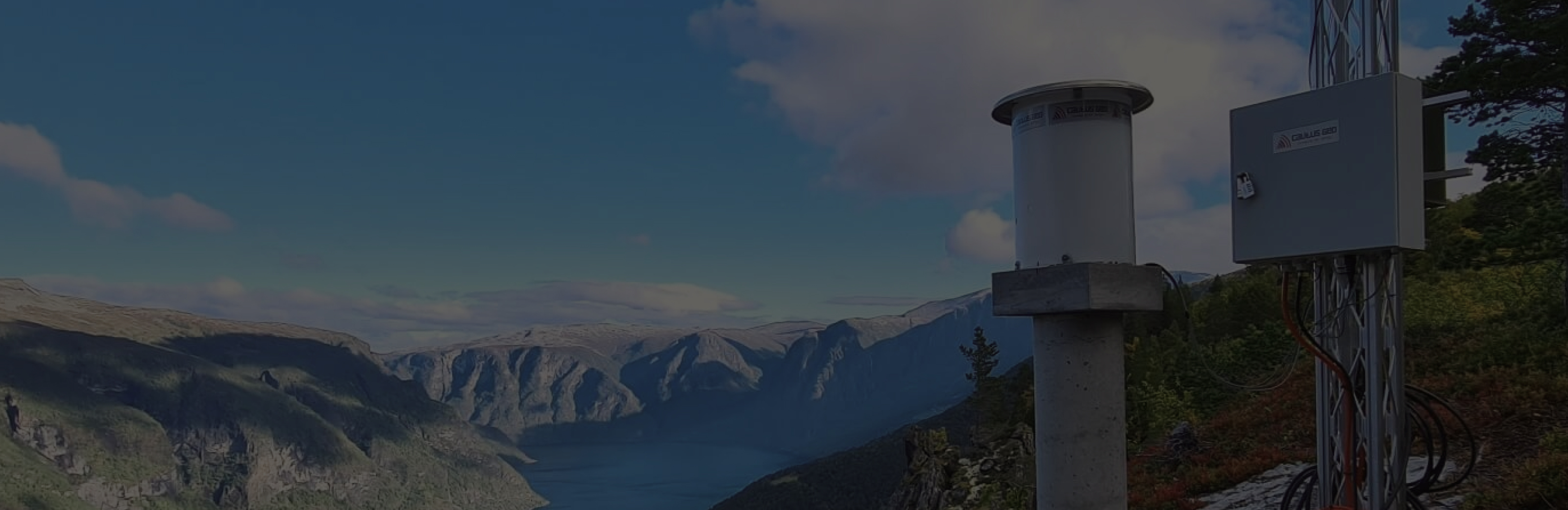
- cameras images visualization
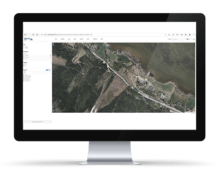
- maps visualization supporting several map layers and different coordinates systems
- alarms rules management
- administration tools
Key Requirements
The primary requirement by CautusGeo included delivering both client and server parts of the portal, ending with many more standalone backend services for data computing purposes.
From a business perspective, CautusGeo was looking for a team with a strong knowledge of maths and physics and a technical background to implement a stable web portal that could handle queries returning thousands of measurements with ease.
CautusGeo wanted to bring a new, innovative solution that didn’t exist on the market and needed a reliable tech partner for a long-term collaboration.

How we did it
Initially, the Applandeo team got involved in requirements analysis and software planning. Once the proof of concept phase was finalized, our team became a part of a one-year development phase during which we created a basic measurements visualization web app.
We formed a dedicated project team of four developers, a DevOps engineer, UX designer, and manual tester working closely with the product owner on the CautusGeo site. To manage the workflow and progress, we extensively use the Agile approach with weekly sprint planning.
For both analysis, plan, and development processes, we proposed an iterative approach.
Technology Stack
Backend Tech Stack:
- Asp.Net Core and .Net Core
- SQL Server and EntityFramework Core
- RabbitMQ and MassTransit
- Azure Telemetry and Azure Monitor alarms
- NLog, Serilog
- Elastic search and Jaeger
Frontend Tech Stack:
- Angular, Angular Material
- Highcharts, Plotly, Open layers
DevOps:
- Teamcity, Cypress, Docker, Azure App Services, Azure Containers
The backend technology stack uses the .Net Core environment. It includes API services and several different service workers altogether connected in a microservice architecture. The backend part extensively uses RabbitMQ for event propagation. The client part for the web application is built as an Angular SPA.
The system interface uses Twilio and Sendgrid external systems for SMS and Email delivery.

The Outcome
What came as a result is a production-ready and stable web portal tool monitored with many health checks and live subsystems.
Cautus Web has become a complex and mature web application that handles a wide range of sensors. It is subject to constant improvement and new features.
It is currently used in multiple projects covering real-time monitoring of natural hazards, climate, water quality, constructions, and ground conditions.
Bringing it to life is a significant step for real-time natural disaster monitoring. Cautus Web brings the next level of security together with one-step-ahead protection of human life.
The long-term cooperation between Applandeo and Cautus Geo is continuing.
Applandeo has been recently working with the Cautus Geo team, developing another project within their monitoring system.

Find us on Clutch
Take a look at our profile on the world’s largest B2B reviews site, Clutch,
to see what others are saying about us and how we work.
Let’s chat!
 Hi, I’m Marcin, COO of Applandeo
Are you looking for a tech partner? Searching for a new job? Or do you simply have any feedback that you’d like to share with our team? Whatever brings you to us, we’ll do our best to help you. Don’t hesitate and drop us a message!
Drop a message